
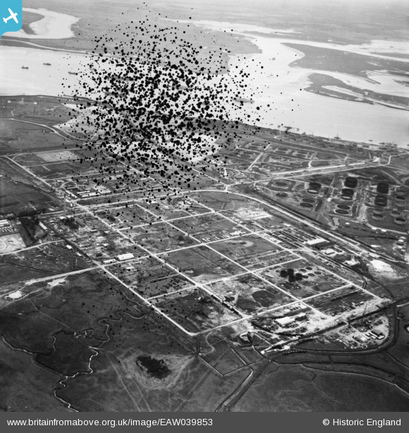
EAW039853 ENGLAND (1951). The Anglo-Iranian Oil Co oil refinery under construction, Isle of Grain, from the north, 1951. This image has been produced from a damaged negative.
© Copyright OpenStreetMap contributors and licensed by the OpenStreetMap Foundation. 2026. Cartography is licensed as CC BY-SA.
Details
| Title | [EAW039853] The Anglo-Iranian Oil Co oil refinery under construction, Isle of Grain, from the north, 1951. This image has been produced from a damaged negative. |
| Reference | EAW039853 |
| Date | 20-August-1951 |
| Link | |
| Place name | ISLE OF GRAIN |
| Parish | ISLE OF GRAIN |
| District | |
| Country | ENGLAND |
| Easting / Northing | 586713, 175962 |
| Longitude / Latitude | 0.68751095293511, 51.451320343803 |
| National Grid Reference | TQ867760 |
Pins

redmist |
Sunday 21st of June 2020 10:56:54 PM | |
|
Curtisden |
Friday 25th of July 2014 03:47:01 PM | |
|
Curtisden |
Friday 25th of July 2014 03:46:31 PM | |
|
Curtisden |
Friday 25th of July 2014 03:46:13 PM |