
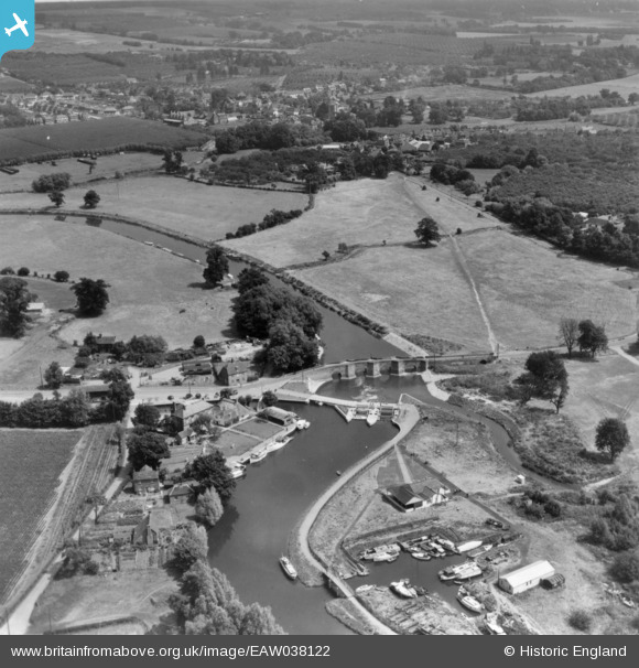
EAW038122 ENGLAND (1951). Twyford Bridge over the River Medway and environs, Yalding, 1951. This image has been produced from a print.
© Copyright OpenStreetMap contributors and licensed by the OpenStreetMap Foundation. 2026. Cartography is licensed as CC BY-SA.
Details
| Title | [EAW038122] Twyford Bridge over the River Medway and environs, Yalding, 1951. This image has been produced from a print. |
| Reference | EAW038122 |
| Date | 25-July-1951 |
| Link | |
| Place name | YALDING |
| Parish | YALDING |
| District | |
| Country | ENGLAND |
| Easting / Northing | 569117, 149825 |
| Longitude / Latitude | 0.42208072764604, 51.222017811271 |
| National Grid Reference | TQ691498 |
Pins

Kentishman |
Monday 26th of January 2026 05:06:17 PM | |
|
Kentishman |
Monday 26th of January 2026 05:02:13 PM | |
|
Kentishman |
Monday 26th of January 2026 05:00:31 PM | |
|
Kentishman |
Monday 26th of January 2026 04:50:00 PM | |
|
cptpies |
Wednesday 27th of November 2019 03:50:47 PM | |
-em.jpg)
hawkeye |
Tuesday 1st of December 2015 05:20:51 PM | |
|
hawkeye |
Tuesday 1st of December 2015 05:19:57 PM | |
|
hawkeye |
Tuesday 1st of December 2015 05:16:17 PM | |
|
Kentishman |
Thursday 10th of September 2015 09:45:43 AM | |
|
Kentishman |
Thursday 10th of September 2015 09:26:05 AM | |
|
Kentishman |
Thursday 1st of January 2015 09:27:44 AM | |
|
Kentishman |
Thursday 1st of January 2015 09:18:38 AM | |
|
Kentishman |
Thursday 1st of January 2015 09:17:45 AM | |
|
Kentishman |
Thursday 1st of January 2015 09:15:54 AM | |
|
Kentishman |
Thursday 1st of January 2015 09:15:08 AM | |
|
Kentishman |
Thursday 1st of January 2015 09:12:53 AM | |
|
Kentishman |
Thursday 1st of January 2015 09:10:42 AM |