
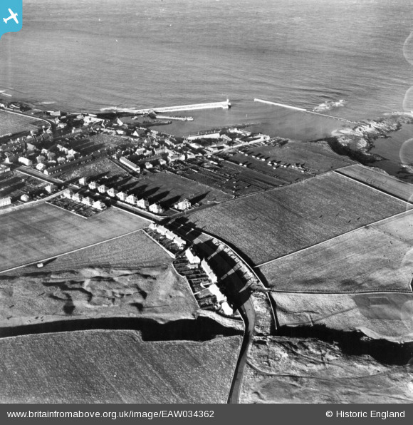
EAW034362 ENGLAND (1950). The village, Seahouses, 1950. This image has been produced from a print.
© Copyright OpenStreetMap contributors and licensed by the OpenStreetMap Foundation. 2025. Cartography is licensed as CC BY-SA.
Details
| Title | [EAW034362] The village, Seahouses, 1950. This image has been produced from a print. |
| Reference | EAW034362 |
| Date | 25-November-1950 |
| Link | |
| Place name | SEAHOUSES |
| Parish | NORTH SUNDERLAND |
| District | |
| Country | ENGLAND |
| Easting / Northing | 422195, 631787 |
| Longitude / Latitude | -1.6479078660198, 55.579226822581 |
| National Grid Reference | NU222318 |
Pins

Matt Aldred edob.mattaldred.com |
Thursday 31st of December 2020 03:53:17 PM | |

cptpies |
Friday 21st of December 2018 10:08:32 AM | |

melgibbs |
Wednesday 3rd of December 2014 04:51:09 PM | |
|
melgibbs |
Wednesday 3rd of December 2014 04:49:06 PM | |
|
melgibbs |
Wednesday 3rd of December 2014 04:46:33 PM |
