
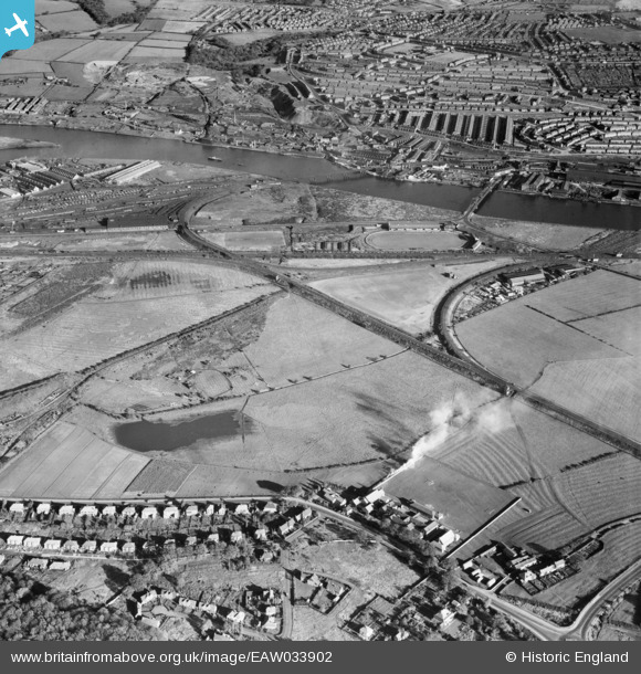
EAW033902 ENGLAND (1950). Swalwell Junction, Blaydon Junction and environs, Blaydon, 1950
© Copyright OpenStreetMap contributors and licensed by the OpenStreetMap Foundation. 2026. Cartography is licensed as CC BY-SA.
Details
| Title | [EAW033902] Swalwell Junction, Blaydon Junction and environs, Blaydon, 1950 |
| Reference | EAW033902 |
| Date | 19-October-1950 |
| Link | |
| Place name | BLAYDON |
| Parish | |
| District | |
| Country | ENGLAND |
| Easting / Northing | 419598, 563133 |
| Longitude / Latitude | -1.6938869397282, 54.962366085876 |
| National Grid Reference | NZ196631 |
Pins

Tired Hiker |
Friday 12th of December 2025 12:35:21 PM | |
|
redmist |
Tuesday 5th of November 2019 08:47:45 PM | |
|
redmist |
Tuesday 5th of November 2019 08:43:52 PM | |
|
redmist |
Tuesday 5th of November 2019 08:43:21 PM | |
|
redmist |
Tuesday 5th of November 2019 08:39:57 PM | |
|
Chris Kolonko |
Friday 15th of September 2017 10:09:49 PM | |
|
gerry-r |
Sunday 22nd of June 2014 12:54:47 PM |