
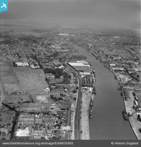
EAW031893 ENGLAND (1950). The River Yare, Great Yarmouth, from the south, 1950
© Copyright OpenStreetMap contributors and licensed by the OpenStreetMap Foundation. 2026. Cartography is licensed as CC BY-SA.
Details
| Title | [EAW031893] The River Yare, Great Yarmouth, from the south, 1950 |
| Reference | EAW031893 |
| Date | 14-August-1950 |
| Link | |
| Place name | GREAT YARMOUTH |
| Parish | |
| District | |
| Country | ENGLAND |
| Easting / Northing | 652375, 306117 |
| Longitude / Latitude | 1.7267687787529, 52.5937792957 |
| National Grid Reference | TG524061 |
Pins

Bill_Gensheet |
Sunday 24th of June 2018 03:33:30 PM | |
|
Bill_Gensheet |
Sunday 24th of June 2018 03:32:07 PM | |
|
Bill_Gensheet |
Sunday 24th of June 2018 03:28:53 PM | |
|
mannidaze |
Sunday 20th of November 2016 07:35:39 PM |