
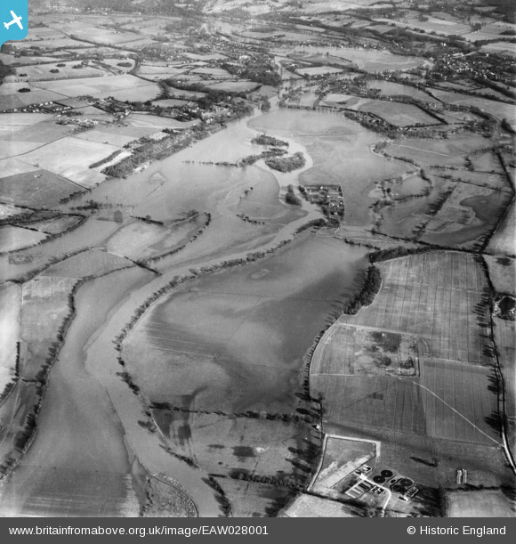
EAW028001 ENGLAND (1950). The River Thames in flood between Sonning and Shiplake, Sonning, from the south-west, 1950
© Copyright OpenStreetMap contributors and licensed by the OpenStreetMap Foundation. 2025. Cartography is licensed as CC BY-SA.
Details
| Title | [EAW028001] The River Thames in flood between Sonning and Shiplake, Sonning, from the south-west, 1950 |
| Reference | EAW028001 |
| Date | 17-February-1950 |
| Link | |
| Place name | SONNING |
| Parish | SONNING |
| District | |
| Country | ENGLAND |
| Easting / Northing | 475968, 176150 |
| Longitude / Latitude | -0.90595078957488, 51.478714717245 |
| National Grid Reference | SU760762 |
Pins
Be the first to add a comment to this image!