
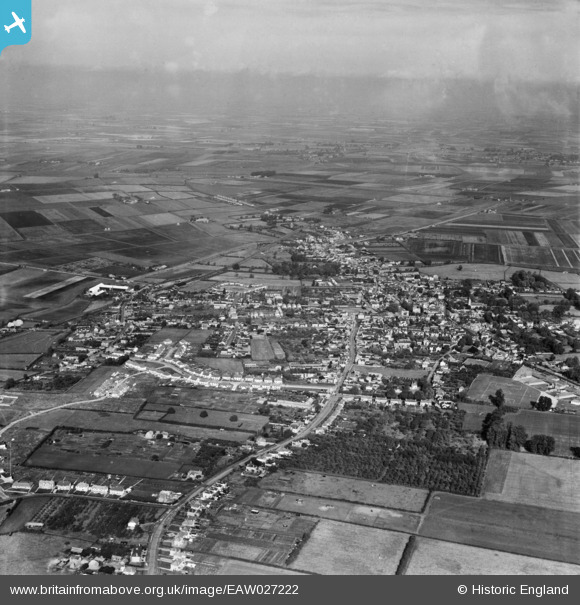
EAW027222 ENGLAND (1949). The town, Chatteris, from the south, 1949
© Copyright OpenStreetMap contributors and licensed by the OpenStreetMap Foundation. 2026. Cartography is licensed as CC BY-SA.
Details
| Title | [EAW027222] The town, Chatteris, from the south, 1949 |
| Reference | EAW027222 |
| Date | 12-October-1949 |
| Link | |
| Place name | CHATTERIS |
| Parish | CHATTERIS |
| District | |
| Country | ENGLAND |
| Easting / Northing | 539216, 285238 |
| Longitude / Latitude | 0.048665837881347, 52.446968970731 |
| National Grid Reference | TL392852 |
Pins

Ferrers |
Saturday 12th of February 2022 01:19:14 PM | |

H.E. |
Thursday 10th of February 2022 05:42:39 PM | |
|
H.E. |
Thursday 10th of February 2022 11:46:47 AM | |
|
H.E. |
Thursday 10th of February 2022 11:46:18 AM | |
|
H.E. |
Thursday 10th of February 2022 11:29:32 AM | |
|
H.E. |
Thursday 10th of February 2022 11:27:30 AM | |
|
H.E. |
Thursday 10th of February 2022 11:26:34 AM | |
|
H.E. |
Thursday 10th of February 2022 11:23:59 AM |