
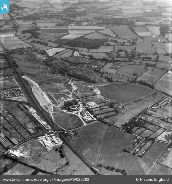
EAW026292 ENGLAND (1949). Rye House Power Station under construction and the surrounding area, Rye Park, 1949. This image has been produced from a print.
© Copyright OpenStreetMap contributors and licensed by the OpenStreetMap Foundation. 2026. Cartography is licensed as CC BY-SA.
Nearby Images (48)
EAW036386

EAW036384

EAW028691

EAW034492

EAW047238

EAW047239

EAW036385

EAW036389

EAW028698

EAW022407

EAW027799

EAW026279

EAW026284

EAW036392

EAW028692

EAW032362

EAW028697

EAW036393

EAW042023

EAW032363

EAW034493

EAW028688

EAW040611

EAW047237

EAW040612

EAW040613

EAW042016

EAW042024

EAW050628

EAW042019

EAW047234

EAW040622

EAW026289

EAW034503

EAW026281

EAW028695

EAW036380

EAW047248

EAW027790

EAW047245

EAW036388

EAW036383

EAW042017

EAW032364

EAW040624

EAW047243

EAW040621

EAW027788

Details
| Title | [EAW026292] Rye House Power Station under construction and the surrounding area, Rye Park, 1949. This image has been produced from a print. |
| Reference | EAW026292 |
| Date | 19-August-1949 |
| Link | |
| Place name | RYE PARK |
| Parish | |
| District | |
| Country | ENGLAND |
| Easting / Northing | 538867, 208804 |
| Longitude / Latitude | 0.012367418967958, 51.760226015014 |
| National Grid Reference | TL389088 |
Pins
Be the first to add a comment to this image!