
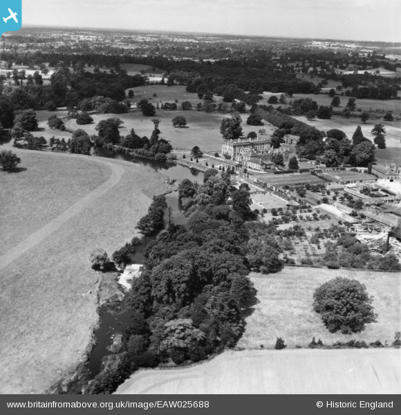
EAW025688 ENGLAND (1949). Stoneleigh Abbey, Stoneleigh, from the south-east, 1949. This image has been produced from a print.
© Copyright OpenStreetMap contributors and licensed by the OpenStreetMap Foundation. 2025. Cartography is licensed as CC BY-SA.
Details
| Title | [EAW025688] Stoneleigh Abbey, Stoneleigh, from the south-east, 1949. This image has been produced from a print. |
| Reference | EAW025688 |
| Date | 4-August-1949 |
| Link | |
| Place name | STONELEIGH |
| Parish | STONELEIGH |
| District | |
| Country | ENGLAND |
| Easting / Northing | 432178, 270998 |
| Longitude / Latitude | -1.5276903902509, 52.335735526178 |
| National Grid Reference | SP322710 |
Pins
Be the first to add a comment to this image!