
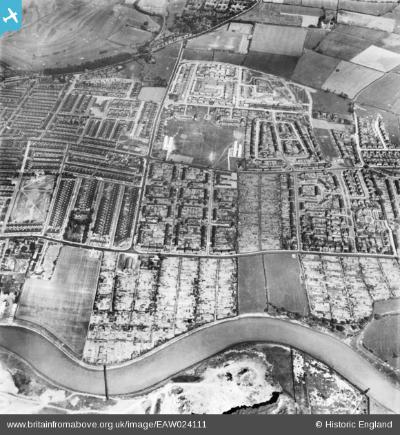
EAW024111 ENGLAND (1949). The town, Thornaby-on-Tees, 1949. This image has been produced from a print.
© Copyright OpenStreetMap contributors and licensed by the OpenStreetMap Foundation. 2026. Cartography is licensed as CC BY-SA.
Details
| Title | [EAW024111] The town, Thornaby-on-Tees, 1949. This image has been produced from a print. |
| Reference | EAW024111 |
| Date | 22-June-1949 |
| Link | |
| Place name | THORNABY-ON-TEES |
| Parish | THORNABY |
| District | |
| Country | ENGLAND |
| Easting / Northing | 445209, 517327 |
| Longitude / Latitude | -1.3010054925524, 54.549047112482 |
| National Grid Reference | NZ452173 |
Pins
 Acklam Road (A1130) Acklam Road (A1130) |

Saul Marks |
Tuesday 26th of May 2026 03:13:03 AM |
| 127 & 129 Westbury Street (future site of Thornaby Mosque) |
Saul Marks |
Tuesday 26th of May 2026 03:11:48 AM |
| Swimming baths |
kenny |
Tuesday 28th of November 2023 07:50:29 PM |
| Cenotaph |
Doug |
Monday 7th of December 2020 01:42:34 PM |
| Littleboy Park |
Doug |
Monday 7th of December 2020 01:40:34 PM |
| Arthur Head School |
Doug |
Monday 7th of December 2020 01:37:59 PM |
| Victoria Recreation Ground |
J May |
Monday 7th of August 2017 01:05:33 PM |