
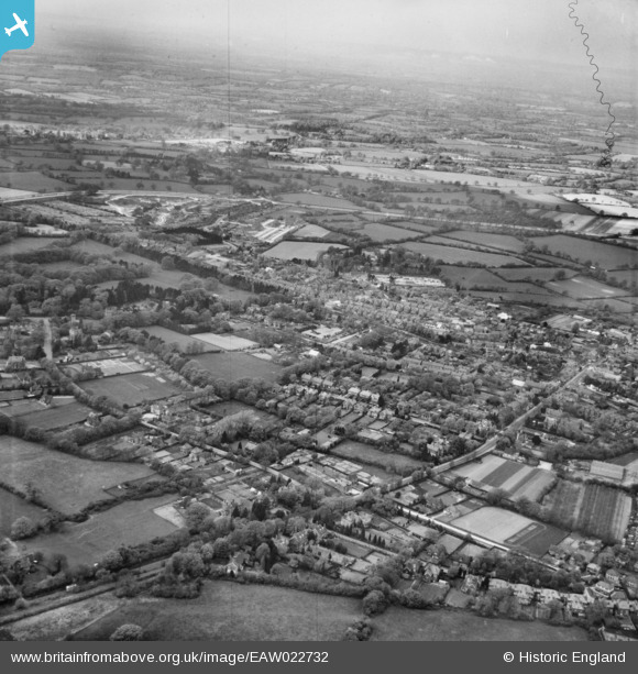
EAW022732 ENGLAND (1949). The town, Crawley, from the south-east, 1949
© Copyright OpenStreetMap contributors and licensed by the OpenStreetMap Foundation. 2026. Cartography is licensed as CC BY-SA.
Details
| Title | [EAW022732] The town, Crawley, from the south-east, 1949 |
| Reference | EAW022732 |
| Date | 29-April-1949 |
| Link | |
| Place name | CRAWLEY |
| Parish | |
| District | |
| Country | ENGLAND |
| Easting / Northing | 526631, 135973 |
| Longitude / Latitude | -0.19089846398269, 51.108518115914 |
| National Grid Reference | TQ266360 |
Pins

Sparky |
Sunday 27th of August 2017 09:29:10 PM | |
So What? |

brianbeckett |
Monday 1st of June 2020 02:15:30 PM |
|
gBr |
Monday 12th of October 2015 09:35:35 PM |