
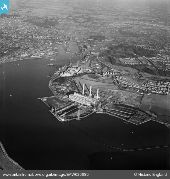
EAW020685 ENGLAND (1948). Cliff Quay Power Station under construction and the docks, Ipswich, from the south-east, 1948
© Copyright OpenStreetMap contributors and licensed by the OpenStreetMap Foundation. 2026. Cartography is licensed as CC BY-SA.
Nearby Images (48)
EAW008085

EAW033197

EAW012453

EAW024334

EAW024333

EAW017564

EAW027815

EAW020667

EAW020671

EAW024329

EAW033198

EAW027820

EAW027824

EAW027819

EAW017568

EAW002322

EAW020689

EAW008078

EAW024325

EAW033192

EAW012452

EAW027812

EAW012456

EAW002327

EAW027822

EAW033195

EAW027823

EAW017570

EAW020687

EAW027825

EAW024332

EAW024336

EAW027830

EAW017565

EAW017563

EAW024322

EAW024338

EAW017569

EAW027821

EAW012451

EAW017581
 and environs, Ipswich, 1948. This image has been produced from a damaged negative.")
EAW033204

EAW012449

EAW033200

EAW017578

EAW017579

EAW033199

EAW008082

Details
| Title | [EAW020685] Cliff Quay Power Station under construction and the docks, Ipswich, from the south-east, 1948 |
| Reference | EAW020685 |
| Date | 16-December-1948 |
| Link | |
| Place name | IPSWICH |
| Parish | |
| District | |
| Country | ENGLAND |
| Easting / Northing | 617021, 241821 |
| Longitude / Latitude | 1.1641811176185, 52.031838946118 |
| National Grid Reference | TM170418 |
Pins
Be the first to add a comment to this image!