
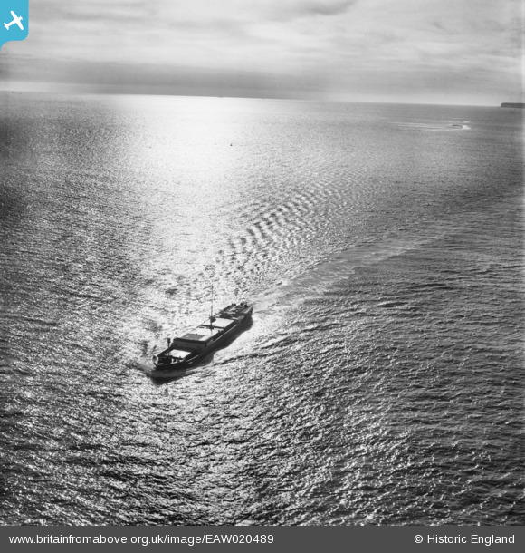
EAW020489 ENGLAND (1948) [Unlocated]. An unidentified vessel at sea off the Kent coast, 1948
© Copyright OpenStreetMap contributors and licensed by the OpenStreetMap Foundation. 2026. Cartography is licensed as CC BY-SA.
Nearby Images (48)
EPW000143

EPW000667

EPW005260

EPW006389
, 1921")
EPW007181

EPW015853

EPW015854

EPW015855

EPW016012

EPW016510

EPW016641

EPW017028

EPW017029

EPW017136

SAW003585

SAW003586

SAW009337

SAW009800

SAW009801

SAW009802

SAW010734

SAW014737

SAW017926

SAW017927

SAW032504

SPW020275

SPW020280

SPW020281

SPW020284

SPW020632

SPW020633

SPW027083

SPW049776

SPW049777

SPW049779

SPW049783

SPW049791

SPW049798

SPW049801

SPW049827

SPW049828

SPW049831

SPW049832

SPW049834

SPW049948

SPW049949

SPW051009

SPW062638

Details
| Title | [EAW020489] An unidentified vessel at sea off the Kent coast, 1948 |
| Reference | EAW020489 |
| Date | 9-November-1948 |
| Link | |
| Place name | |
| Parish | |
| District | |
| Country | ENGLAND |
| Easting / Northing | 0, 0 |
| Longitude / Latitude | -7.556448482059, 49.766185796754 |
| National Grid Reference | SV000000 |
Pins
Be the first to add a comment to this image!
User Comment Contributions
Vessel is the British "flatiron" collier "FULHAM IX", built earlier in 1948 for the British Electricity Authority, London. She supplied electricity power stations, mainly in the Thames, with coal from the North East of England and her low profile allowed navigation to upriver London power stations. She was sold in 1970 to Greek owners. See also image EAW020490. |

Leslie |
Saturday 9th of August 2014 09:31:17 AM |