
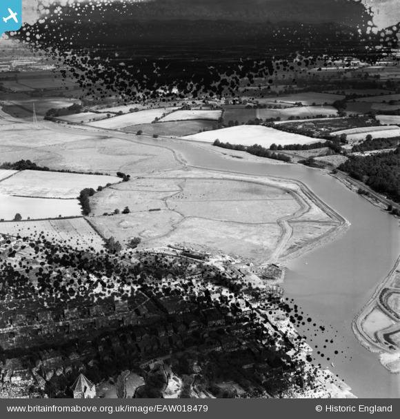
EAW018479 ENGLAND (1948). The Hythe Marshes alongside the River Colne, Colchester, 1948. This image has been produced from a damaged negative.
© Copyright OpenStreetMap contributors and licensed by the OpenStreetMap Foundation. 2026. Cartography is licensed as CC BY-SA.
Details
| Title | [EAW018479] The Hythe Marshes alongside the River Colne, Colchester, 1948. This image has been produced from a damaged negative. |
| Reference | EAW018479 |
| Date | 1-September-1948 |
| Link | |
| Place name | COLCHESTER |
| Parish | |
| District | |
| Country | ENGLAND |
| Easting / Northing | 603080, 222196 |
| Longitude / Latitude | 0.94962957555152, 51.860889609855 |
| National Grid Reference | TM031222 |
Pins

Matt Aldred edob.mattaldred.com |
Wednesday 5th of February 2025 04:11:14 PM |
User Comment Contributions
the village in the bottom of the photo in the damaged part is Rowhedge. The church spire is just visible. |

localyokel |
Saturday 5th of April 2014 07:59:20 AM |