
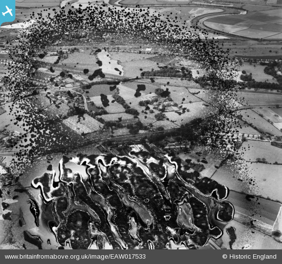
EAW017533 ENGLAND (1948). Thelwall Heys and the surrounding area, Grappenhall, 1948. This image has been produced from a damaged negative.
© Copyright OpenStreetMap contributors and licensed by the OpenStreetMap Foundation. 2026. Cartography is licensed as CC BY-SA.
Details
| Title | [EAW017533] Thelwall Heys and the surrounding area, Grappenhall, 1948. This image has been produced from a damaged negative. |
| Reference | EAW017533 |
| Date | 22-July-1948 |
| Link | |
| Place name | GRAPPENHALL |
| Parish | GRAPPENHALL AND THELWALL |
| District | |
| Country | ENGLAND |
| Easting / Northing | 364629, 386570 |
| Longitude / Latitude | -2.5317229025436, 53.374538073075 |
| National Grid Reference | SJ646866 |
Pins
Be the first to add a comment to this image!