
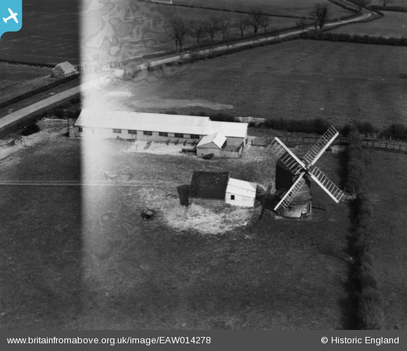
EAW014278 ENGLAND (1948). Kibworth Harcourt Windmill, Kibworth Harcourt, 1948. This image has been produced from a damaged print .
© Copyright OpenStreetMap contributors and licensed by the OpenStreetMap Foundation. 2026. Cartography is licensed as CC BY-SA.
Details
| Title | [EAW014278] Kibworth Harcourt Windmill, Kibworth Harcourt, 1948. This image has been produced from a damaged print . |
| Reference | EAW014278 |
| Date | 12-April-1948 |
| Link | |
| Place name | KIBWORTH HARCOURT |
| Parish | KIBWORTH HARCOURT |
| District | |
| Country | ENGLAND |
| Easting / Northing | 468888, 294438 |
| Longitude / Latitude | -0.98409164806086, 52.543071095491 |
| National Grid Reference | SP689944 |
Pins

K9-Q |
Sunday 8th of November 2015 03:26:22 AM | |
|
K9-Q |
Sunday 8th of November 2015 03:13:14 AM | |
|
K9-Q |
Sunday 8th of November 2015 03:11:08 AM | |
|
K9-Q |
Sunday 8th of November 2015 03:09:15 AM | |
|
K9-Q |
Sunday 8th of November 2015 02:53:30 AM | |
|
K9-Q |
Sunday 8th of November 2015 02:51:23 AM | |
|
K9-Q |
Sunday 8th of November 2015 02:49:40 AM |