
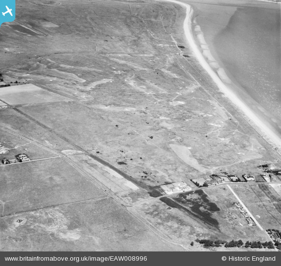
EAW008996 ENGLAND (1947). The Royal St George's Golf Course, Worth, 1947
© Copyright OpenStreetMap contributors and licensed by the OpenStreetMap Foundation. 2026. Cartography is licensed as CC BY-SA.
Details
| Title | [EAW008996] The Royal St George's Golf Course, Worth, 1947 |
| Reference | EAW008996 |
| Date | 12-August-1947 |
| Link | |
| Place name | WORTH |
| Parish | WORTH |
| District | |
| Country | ENGLAND |
| Easting / Northing | 635727, 157930 |
| Longitude / Latitude | 1.3798732386461, 51.271169624502 |
| National Grid Reference | TR357579 |
Pins

Sparky |
Friday 7th of July 2017 08:52:19 AM |