
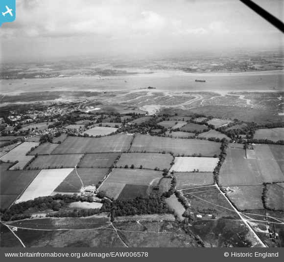
EAW006578 ENGLAND (1947). Fields Farm looking towards Ashlett Creek, Fawley, from the south-west, 1947
© Copyright OpenStreetMap contributors and licensed by the OpenStreetMap Foundation. 2026. Cartography is licensed as CC BY-SA.
Details
| Title | [EAW006578] Fields Farm looking towards Ashlett Creek, Fawley, from the south-west, 1947 |
| Reference | EAW006578 |
| Date | 27-May-1947 |
| Link | |
| Place name | FAWLEY |
| Parish | FAWLEY |
| District | |
| Country | ENGLAND |
| Easting / Northing | 446040, 102462 |
| Longitude / Latitude | -1.3463452180576, 50.819307687287 |
| National Grid Reference | SU460025 |
Pins


User Comment Contributions

Ashlett Creek, 19/05/2016 |

Class31 |
Monday 23rd of May 2016 11:43:20 AM |