
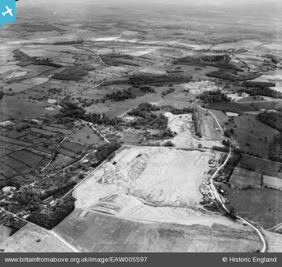
EAW005597 ENGLAND (1947). Opencast coal mining over Windmill Field and Wentworth Park, Wentworth, from the west, 1947
© Copyright OpenStreetMap contributors and licensed by the OpenStreetMap Foundation. 2024. Cartography is licensed as CC BY-SA.
Nearby Images (7)
EAW005597

EAW005595

EAW006260

EAW005596

EAW006259

EAW006265

EAW003480

Details
| Title | [EAW005597] Opencast coal mining over Windmill Field and Wentworth Park, Wentworth, from the west, 1947 |
| Reference | EAW005597 |
| Date | 15-May-1947 |
| Link | |
| Place name | WENTWORTH |
| Parish | WENTWORTH |
| District | |
| Country | ENGLAND |
| Easting / Northing | 438647, 397868 |
| Longitude / Latitude | -1.417646235623, 53.47586755358 |
| National Grid Reference | SK386979 |


