
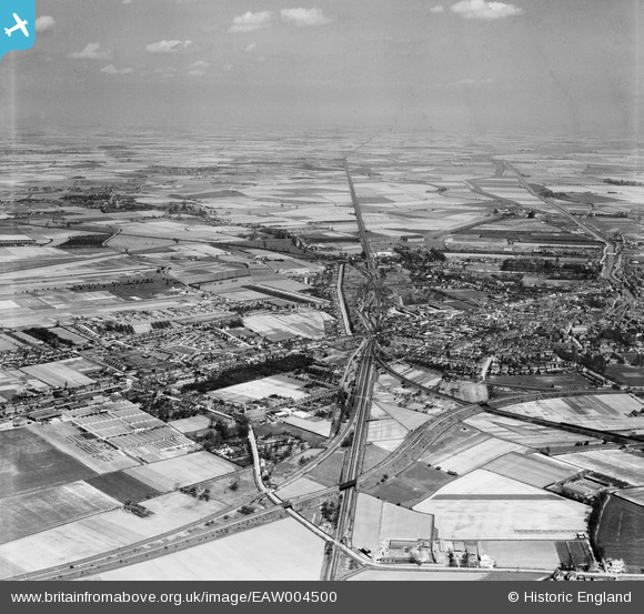
EAW004500 ENGLAND (1947). The town and surrounding fenland, Spalding, from the south-west, 1947
© Copyright OpenStreetMap contributors and licensed by the OpenStreetMap Foundation. 2026. Cartography is licensed as CC BY-SA.
Details
| Title | [EAW004500] The town and surrounding fenland, Spalding, from the south-west, 1947 |
| Reference | EAW004500 |
| Date | 16-April-1947 |
| Link | |
| Place name | SPALDING |
| Parish | |
| District | |
| Country | ENGLAND |
| Easting / Northing | 523900, 321945 |
| Longitude / Latitude | -0.16282826182019, 52.780514157745 |
| National Grid Reference | TF239219 |
Pins

redmist |
Wednesday 6th of October 2021 07:13:39 PM | |

Grimsby Boy |
Wednesday 22nd of May 2019 09:39:56 PM | |

bescotbeast |
Thursday 27th of February 2014 07:56:13 PM | |
|
bescotbeast |
Thursday 27th of February 2014 07:55:23 PM | |
|
bescotbeast |
Thursday 27th of February 2014 07:54:51 PM | |
|
bescotbeast |
Thursday 27th of February 2014 07:53:35 PM | |
|
pab |
Wednesday 29th of January 2014 04:36:50 PM | |
|
pab |
Wednesday 29th of January 2014 04:36:01 PM | |
|
pab |
Wednesday 29th of January 2014 04:30:54 PM | |
|
pab |
Wednesday 29th of January 2014 04:29:56 PM | |
|
pab |
Wednesday 29th of January 2014 04:27:55 PM | |
|
pab |
Wednesday 29th of January 2014 04:26:28 PM | |
|
pab |
Wednesday 29th of January 2014 04:22:21 PM | |
|
pab |
Wednesday 29th of January 2014 04:20:28 PM | |
|
Bayman1 |
Wednesday 29th of January 2014 01:20:19 PM | |
2 still open Boston & Peterborough 4 closed Bourne March Boston & Holbeach I've put pins on photo |
pab |
Wednesday 29th of January 2014 04:34:53 PM |
The line to Boston is not open. It closed in 1970. I think you mean the line to Sleaford which survives along with the Peterborough line. |
Jonny777 |
Friday 28th of February 2014 04:33:18 PM |
|
dhayes |
Tuesday 28th of January 2014 06:32:30 PM | |
Owned by J.J. Hayes |
dhayes |
Tuesday 28th of January 2014 10:29:02 PM |