
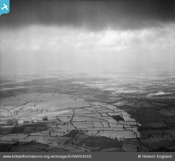
EAW004015 ENGLAND (1947). Flooding at Longdon Marsh and Marsh End, Longdon, from the south, 1947
© Copyright OpenStreetMap contributors and licensed by the OpenStreetMap Foundation. 2026. Cartography is licensed as CC BY-SA.
Details
| Title | [EAW004015] Flooding at Longdon Marsh and Marsh End, Longdon, from the south, 1947 |
| Reference | EAW004015 |
| Date | 21-March-1947 |
| Link | |
| Place name | LONGDON |
| Parish | LONGDON |
| District | |
| Country | ENGLAND |
| Easting / Northing | 382749, 235227 |
| Longitude / Latitude | -2.251394283914, 52.014777364858 |
| National Grid Reference | SO827352 |
Pins

User Comment Contributions
Hi Class31, Thanks for the location pins! We'll update the catalogue and post your new data here in due course. Yours, Katy Britain from Above Cataloguing Team Leader |
Katy Whitaker |
Tuesday 3rd of September 2013 01:01:23 PM |