
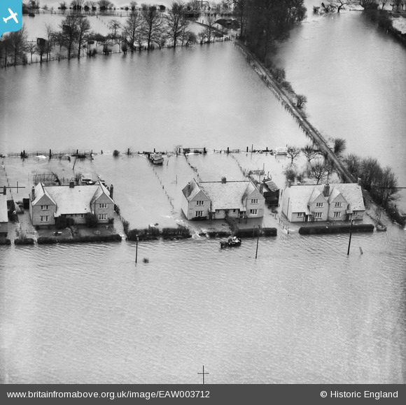
EAW003712 ENGLAND (1947). Houses at South View on Etonwick Road in floodwater, Eton, 1947
© Copyright OpenStreetMap contributors and licensed by the OpenStreetMap Foundation. 2026. Cartography is licensed as CC BY-SA.
Details
| Title | [EAW003712] Houses at South View on Etonwick Road in floodwater, Eton, 1947 |
| Reference | EAW003712 |
| Date | 18-March-1947 |
| Link | |
| Place name | ETON |
| Parish | ETON |
| District | |
| Country | ENGLAND |
| Easting / Northing | 495779, 178183 |
| Longitude / Latitude | -0.62017181040653, 51.493983129809 |
| National Grid Reference | SU958782 |
Pins

Billy Turner |
Friday 12th of February 2016 01:33:48 PM | |

Class31 |
Friday 13th of September 2013 11:05:26 PM | |
|
Class31 |
Friday 13th of September 2013 09:33:03 PM | |
|
Class31 |
Friday 13th of September 2013 09:23:35 PM | |
|
Class31 |
Friday 13th of September 2013 09:21:15 PM | |
|
Class31 |
Friday 13th of September 2013 09:17:22 PM |

User Comment Contributions
Hi Class31, Thanks for the location details - we'll update the catalogue with the new information and post the updated record here in due course. Yours, Katy Britain from Above Cataloguing Team Leader |
Katy Whitaker |
Friday 1st of November 2013 02:53:43 PM |
View looking north. |
Class31 |
Friday 13th of September 2013 09:17:58 PM |
Eureka I've been here before on Britain from Above. |
Class31 |
Friday 13th of September 2013 09:14:55 PM |