
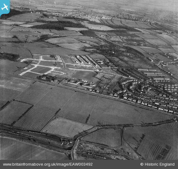
EAW003492 ENGLAND (1947). Rawmarsh School, Haugh Road Cemetery and environs, Rawmarsh, 1947
© Copyright OpenStreetMap contributors and licensed by the OpenStreetMap Foundation. 2024. Cartography is licensed as CC BY-SA.
Nearby Images (2)
EAW003492

EAW003506

Details
| Title | [EAW003492] Rawmarsh School, Haugh Road Cemetery and environs, Rawmarsh, 1947 |
| Reference | EAW003492 |
| Date | 12-January-1947 |
| Link | |
| Place name | RAWMARSH |
| Parish | |
| District | |
| Country | ENGLAND |
| Easting / Northing | 443385, 396769 |
| Longitude / Latitude | -1.3464081212495, 53.465619527528 |
| National Grid Reference | SK434968 |
Pins
 Waynos |
Wednesday 12th of May 2021 03:03:15 PM | |
KHMILLER |
Saturday 4th of July 2020 03:39:40 PM | |
Holmes Junction |
Thursday 12th of December 2013 02:32:31 PM | |
CliveJ |
Sunday 17th of November 2013 03:43:34 PM | |
CliveJ |
Sunday 17th of November 2013 03:39:58 PM |


