
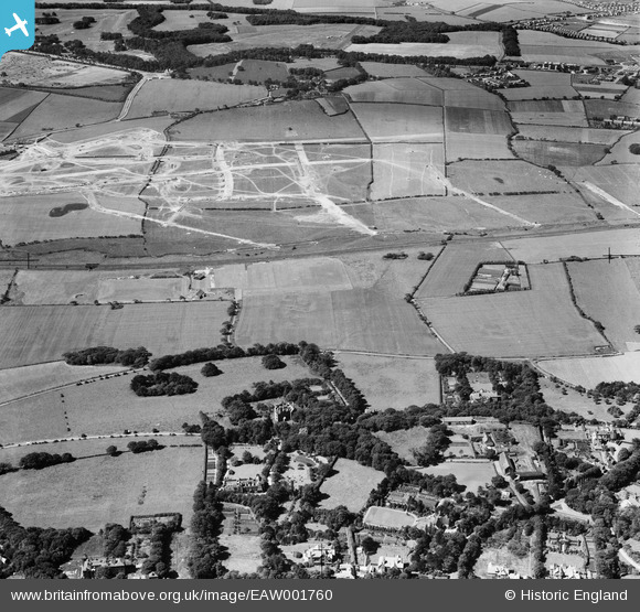
EAW001760 ENGLAND (1946). Wethersfield, construction of new roads for the Woodchurch Estate and environs, Noctorum, 1946
© Copyright OpenStreetMap contributors and licensed by the OpenStreetMap Foundation. 2025. Cartography is licensed as CC BY-SA.
Details
| Title | [EAW001760] Wethersfield, construction of new roads for the Woodchurch Estate and environs, Noctorum, 1946 |
| Reference | EAW001760 |
| Date | 11-July-1946 |
| Link | |
| Place name | NOCTORUM |
| Parish | |
| District | |
| Country | ENGLAND |
| Easting / Northing | 328651, 387506 |
| Longitude / Latitude | -3.0727043555793, 53.37931726166 |
| National Grid Reference | SJ287875 |
Pins

flagermus |
Tuesday 24th of January 2023 12:02:17 PM | |

Matt Aldred edob.mattaldred.com |
Monday 23rd of November 2020 09:00:25 PM | |
|
redmist |
Wednesday 9th of October 2019 09:07:39 PM | |
|
redmist |
Wednesday 9th of October 2019 09:02:58 PM | |
|
cptpies |
Tuesday 3rd of January 2017 08:14:47 AM | |
|
KeithS |
Saturday 24th of May 2014 09:20:36 PM | |
|
Pete65 |
Wednesday 12th of February 2014 05:00:52 AM | |
|
hughes di |
Tuesday 21st of January 2014 07:46:40 PM | |
|
hughes di |
Tuesday 21st of January 2014 07:45:45 PM | |
|
hughes di |
Tuesday 21st of January 2014 07:45:06 PM | |
|
hughes di |
Tuesday 21st of January 2014 07:44:02 PM | |
|
hughes di |
Tuesday 21st of January 2014 07:41:57 PM | |
|
hughes di |
Tuesday 21st of January 2014 07:40:06 PM |