
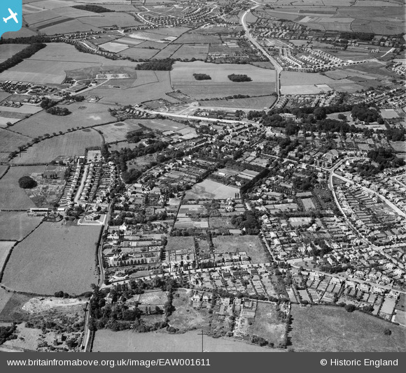
EAW001611 ENGLAND (1946). The village, Upton, 1946
© Copyright OpenStreetMap contributors and licensed by the OpenStreetMap Foundation. 2026. Cartography is licensed as CC BY-SA.
Details
| Title | [EAW001611] The village, Upton, 1946 |
| Reference | EAW001611 |
| Date | 11-July-1946 |
| Link | |
| Place name | UPTON |
| Parish | |
| District | |
| Country | ENGLAND |
| Easting / Northing | 327355, 388169 |
| Longitude / Latitude | -3.0923378798204, 53.38509966236 |
| National Grid Reference | SJ274882 |
Pins
 Graveyard remains from Greenbank Church Graveyard remains from Greenbank Church |

Kylix |
Wednesday 19th of August 2015 06:57:08 PM |
| Site of the "Stone Man." |
Kylix |
Wednesday 19th of August 2015 06:49:33 PM |
| Eagle & Crown |
Kylix |
Wednesday 19th of August 2015 06:28:00 PM |
| Horse & Jockey |
Kylix |
Wednesday 19th of August 2015 06:26:59 PM |
| Horse & Jockey |
Kylix |
Wednesday 19th of August 2015 06:26:54 PM |
| Upton St Mary's Church. I was confirmed there by the Bishop of Chester in 1964 |
Robbied |
Wednesday 25th of February 2015 03:30:11 PM |
| Upton Garage, by bypass/Sainsbury's). |
Roger Reid |
Monday 6th of October 2014 05:13:02 PM |
| Preparing the site for "the prefabs". |
Roger Reid |
Monday 6th of October 2014 05:10:48 PM |
| The Victory Hall |
Roger Reid |
Monday 6th of October 2014 05:09:17 PM |
| The Convent |
Roger Reid |
Monday 6th of October 2014 05:05:06 PM |
| Upton Library |
Roger Reid |
Monday 6th of October 2014 05:02:36 PM |