
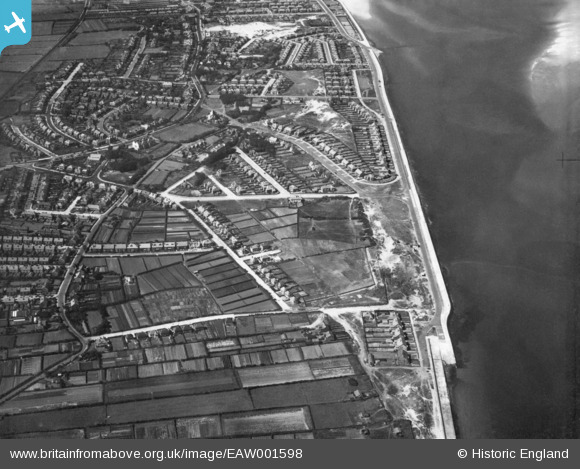
EAW001598 ENGLAND (1946). Meols, Hoylake, 1946. This image has been produced from a print.
© Copyright OpenStreetMap contributors and licensed by the OpenStreetMap Foundation. 2026. Cartography is licensed as CC BY-SA.
Details
| Title | [EAW001598] Meols, Hoylake, 1946. This image has been produced from a print. |
| Reference | EAW001598 |
| Date | 11-July-1946 |
| Link | |
| Place name | HOYLAKE |
| Parish | |
| District | |
| Country | ENGLAND |
| Easting / Northing | 323192, 390367 |
| Longitude / Latitude | -3.1554569081973, 53.404265779181 |
| National Grid Reference | SJ232904 |
Pins

Chris |
Tuesday 27th of February 2024 01:09:38 PM | |
|
Meols Guy |
Wednesday 28th of July 2021 12:27:37 PM | |
|
Meols Guy |
Wednesday 28th of July 2021 12:26:58 PM | |

Matt Aldred edob.mattaldred.com |
Monday 23rd of November 2020 08:56:28 PM | |
|
cptpies |
Friday 15th of December 2017 09:33:38 AM | |

Sparky |
Thursday 14th of September 2017 08:29:50 AM | |
|
Chris Kolonko |
Wednesday 13th of September 2017 02:15:15 PM |