
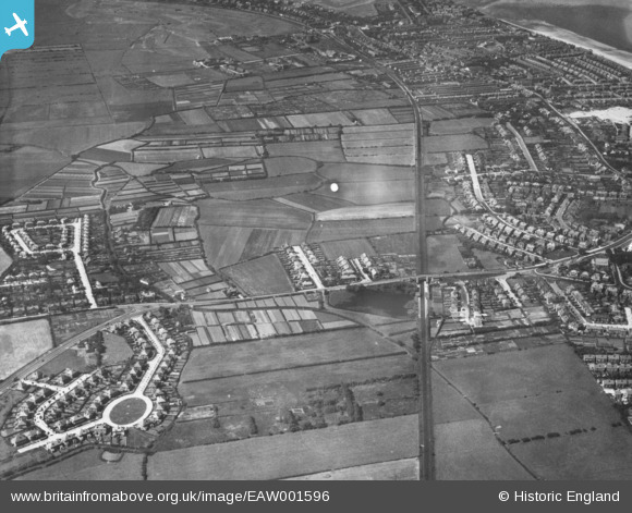
EAW001596 ENGLAND (1946). Farmland at Fornall Bridge, Hoylake, 1946. This image has been produced from a print.
© Copyright OpenStreetMap contributors and licensed by the OpenStreetMap Foundation. 2026. Cartography is licensed as CC BY-SA.
Details
| Title | [EAW001596] Farmland at Fornall Bridge, Hoylake, 1946. This image has been produced from a print. |
| Reference | EAW001596 |
| Date | 11-July-1946 |
| Link | |
| Place name | HOYLAKE |
| Parish | |
| District | |
| Country | ENGLAND |
| Easting / Northing | 323224, 389548 |
| Longitude / Latitude | -3.1547762878712, 53.396909440439 |
| National Grid Reference | SJ232895 |
Pins
 St Hildeburgh's Church (constructed 1897-99) St Hildeburgh's Church (constructed 1897-99) |

Saul Marks |
Monday 25th of May 2026 11:22:15 PM |
| Bertram Lawn Tennis Club, founded 1923 |
Saul Marks |
Monday 25th of May 2026 11:06:32 PM |
| Kingsmead School, founded 1904, closed 2020 |
Saul Marks |
Monday 25th of May 2026 11:04:34 PM |
| YMCA on corner of Hoyle Road and Market Street. Glenda Jackson performed there in 1952-4 with the YMCA players. The Beatles played there just before they became famous in 1962. The men's basketball team won the national championship in 1935/6 and represented England at the Paris Exposition in 1937. |
Peter |
Sunday 18th of June 2023 09:34:32 PM |
| Meols Station |
Meols Guy |
Wednesday 28th of July 2021 11:39:22 AM |
| Dovepoint Road |
Meols Guy |
Wednesday 28th of July 2021 11:38:00 AM |