
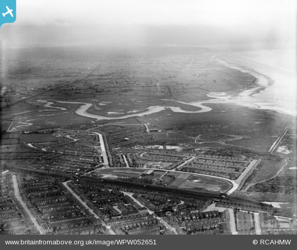
wpw052651 WALES (1937). View of Splott showing park, oblique aerial view. 5"x4" black and white glass plate negative.
© Copyright OpenStreetMap contributors and licensed by the OpenStreetMap Foundation. 2024. Cartography is licensed as CC BY-SA.
Nearby Images (2)
WPW052647

WPW052651

Details
| Title | [WPW052651] View of Splott showing park, oblique aerial view. 5"x4" black and white glass plate negative. |
| Reference | WPW052651 |
| Date | 1937 |
| Link | Coflein Archive Item 6370072 |
| Place name | |
| Parish | |
| District | |
| Country | WALES |
| Easting / Northing | 320671, 176739 |
| Longitude / Latitude | -3.1425746839198, 51.483548787362 |
| National Grid Reference | ST207767 |
Pins
 Class31 |
Monday 28th of July 2014 04:13:14 PM | |
Class31 |
Monday 28th of July 2014 04:12:45 PM | |
Class31 |
Monday 28th of July 2014 04:12:25 PM | |
Class31 |
Monday 28th of July 2014 04:11:49 PM | |
Class31 |
Monday 28th of July 2014 04:11:22 PM | |
Class31 |
Monday 28th of July 2014 04:10:54 PM | |
 hjr |
Friday 29th of June 2012 07:47:40 PM | |
The line is still open as a freight line serving the Tidalfields yard. Connects from the mainline rather than the old TVR line. |
Bishop84 |
Friday 6th of July 2012 08:05:15 PM |


