
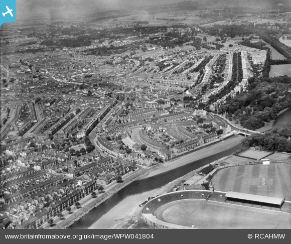
wpw041804 WALES. View of the Riverside area of Cardiff showing Cardiff Arms Park and cricket ground. Oblique aerial photograph.
© Copyright OpenStreetMap contributors and licensed by the OpenStreetMap Foundation. 2024. Cartography is licensed as CC BY-SA.
Nearby Images (7)
WAW015126

WAW015127

WPW029419

WPW038278

WPW041262

WPW041263

WPW041804

Details
| Title | [WPW041804] View of the Riverside area of Cardiff showing Cardiff Arms Park and cricket ground. Oblique aerial photograph. |
| Reference | WPW041804 |
| Date | |
| Link | Coflein Archive Item 6422483 |
| Place name | |
| Parish | |
| District | |
| Country | WALES |
| Easting / Northing | 317902, 176294 |
| Longitude / Latitude | -3.1823441074209, 51.479152691872 |
| National Grid Reference | ST179763 |
Pins
User Comment Contributions
Pre 2nd world war as turreted lodge near park destroyed in the war. |
 Kim |
Sunday 26th of July 2015 08:17:40 PM |


