
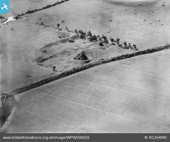
wpw038329 WALES (1932). lime kiln and quarry, Rhoose airport site, oblique aerial view. 5"x4" black and white glass plate negative.
© Copyright OpenStreetMap contributors and licensed by the OpenStreetMap Foundation. 2024. Cartography is licensed as CC BY-SA.
Details
| Title | [WPW038329] lime kiln and quarry, Rhoose airport site, oblique aerial view. 5"x4" black and white glass plate negative. |
| Reference | WPW038329 |
| Date | 1932 |
| Link | Coflein Archive Item 6370921 |
| Place name | |
| Parish | |
| District | |
| Country | WALES |
| Easting / Northing | 305520, 168004 |
| Longitude / Latitude | -3.358401393683, 51.402692024356 |
| National Grid Reference | ST055680 |
Pins
 Andrew Bennett |
Thursday 12th of September 2013 12:44:53 AM | |
SteveAUS |
Tuesday 3rd of July 2012 06:57:24 AM |
User Comment Contributions
On the 1879 1:2500 we can see a. the unusually shaped pond which serves to provide water for three fields b. An old quarry is marked c. An old lime kiln is marked d. The field boundaries match those in our photograph. Well done Andrew Bennett for getting this one which has been unidentified since the launch of the site on 25th June 2012. |
 Class31 |
Thursday 12th of September 2013 08:42:20 AM |
View is looking west. |
Class31 |
Thursday 12th of September 2013 08:34:44 AM |
According to 1879 1:2500 OS map, this is an old lime kiln. No longer visible on ground, within Cardiff Airport. |
Andrew Bennett |
Thursday 12th of September 2013 12:35:26 AM |
this is visible in wpw038328 |
Andrew Bennett |
Thursday 12th of September 2013 12:32:26 AM |


