
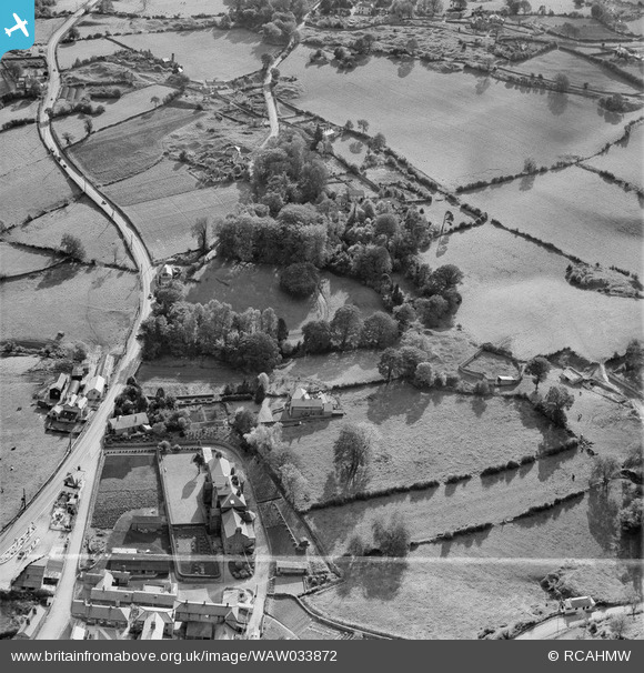
waw033872 WALES (1950). View of area south of Holywell showing Halkyn Road, Stamford Dairy and Lluesty Hospital. Labelled "Holywell Textile Mills Ltd., Highfield & Pistyll".
© Copyright OpenStreetMap contributors and licensed by the OpenStreetMap Foundation. 2024. Cartography is licensed as CC BY-SA.
Nearby Images (7)
WAW033872

WAW033869

WAW033870

WAW033868

WAW033873

WAW033875

WAW033876

Details
| Title | [WAW033872] View of area south of Holywell showing Halkyn Road, Stamford Dairy and Lluesty Hospital. Labelled "Holywell Textile Mills Ltd., Highfield & Pistyll". |
| Reference | WAW033872 |
| Date | 1950 |
| Link | Coflein Archive Item 6414429 |
| Place name | |
| Parish | |
| District | |
| Country | WALES |
| Easting / Northing | 319078, 374876 |
| Longitude / Latitude | -3.213372522093, 53.264422724554 |
| National Grid Reference | SJ191749 |
Pins
 Jamie |
Friday 8th of May 2015 06:54:06 PM | |
 Class31 |
Wednesday 30th of April 2014 04:45:02 PM | |
Andrew Bennett |
Sunday 27th of April 2014 11:09:32 PM | |
Andrew Bennett |
Sunday 27th of April 2014 01:22:46 AM |
User Comment Contributions
View is looking south east. |
Class31 |
Wednesday 30th of April 2014 04:45:26 PM |
Stamford. About half a mile south of Holywell. |
Andrew Bennett |
Sunday 27th of April 2014 01:07:50 AM |


