
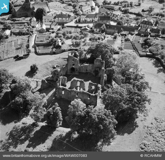
waw007083 WALES (1947). View of Grosmont Castle
© Copyright OpenStreetMap contributors and licensed by the OpenStreetMap Foundation. 2024. Cartography is licensed as CC BY-SA.
Nearby Images (6)
WAW007078

WAW007079

WAW007080

WAW007081

WAW007082

WAW007083

Details
| Title | [WAW007083] View of Grosmont Castle |
| Reference | WAW007083 |
| Date | 11-June-1947 |
| Link | Coflein Archive Item 6413491 |
| Place name | |
| Parish | |
| District | |
| Country | WALES |
| Easting / Northing | 340531, 224454 |
| Longitude / Latitude | -2.8647110666138, 51.91500085418 |
| National Grid Reference | SO405245 |
Pins
 Class31 |
Tuesday 18th of October 2016 08:34:58 PM |
User Comment Contributions
 Grosmont Castle, 11/10/2016 |
Class31 |
Tuesday 18th of October 2016 08:33:34 PM |


