
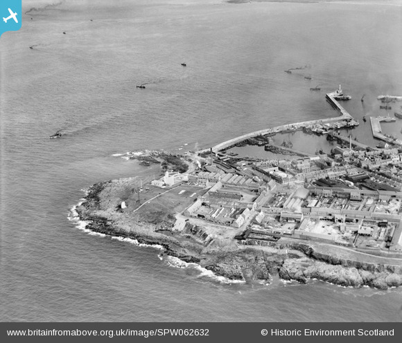
spw062632 SCOTLAND (1939). Fraserburgh, general view, showing Fraserburgh Harbour and Kinnaird Head. An oblique aerial photograph taken facing east.
© Copyright OpenStreetMap contributors and licensed by the OpenStreetMap Foundation. 2024. Cartography is licensed as CC BY-SA.
Nearby Images (5)
SPW062632

SPW062629

SAR036706

SPW062633

SPW062635

Details
| Title | [SPW062632] Fraserburgh, general view, showing Fraserburgh Harbour and Kinnaird Head. An oblique aerial photograph taken facing east. |
| Reference | SPW062632 |
| Date | 1939 |
| Link | Canmore Collection item 1258308 |
| Place name | |
| Parish | FRASERBURGH |
| District | BANFF AND BUCHAN |
| Country | SCOTLAND |
| Easting / Northing | 400000, 867380 |
| Longitude / Latitude | -2, 57.69649377664 |
| National Grid Reference | NK000674 |
Pins
 MB |
Monday 10th of September 2012 03:51:03 PM | |
MB |
Monday 10th of September 2012 03:50:06 PM | |
MB |
Monday 10th of September 2012 03:49:08 PM | |
MB |
Monday 10th of September 2012 03:48:27 PM | |
MB |
Monday 10th of September 2012 03:48:27 PM | |
MB |
Monday 10th of September 2012 03:47:25 PM | |
MB |
Monday 10th of September 2012 03:46:02 PM | |
MB |
Monday 10th of September 2012 03:44:59 PM | |
MB |
Monday 10th of September 2012 03:43:57 PM | |
MB |
Monday 10th of September 2012 03:43:23 PM | |
MB |
Monday 10th of September 2012 03:40:41 PM | |
MB |
Monday 10th of September 2012 03:39:15 PM | |
MB |
Monday 10th of September 2012 03:38:02 PM |


