
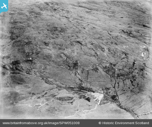
spw051008 SCOTLAND (1936). Glenapp Estate. An oblique aerial photograph facing east.
© Copyright OpenStreetMap contributors and licensed by the OpenStreetMap Foundation. 2024. Cartography is licensed as CC BY-SA.
Details
| Title | [SPW051008] Glenapp Estate. An oblique aerial photograph facing east. |
| Reference | SPW051008 |
| Date | 1936 |
| Link | Canmore Collection item 1258073 |
| Place name | |
| Parish | BALLANTRAE (WIGTOWN) |
| District | WIGTOWN |
| Country | SCOTLAND |
| Easting / Northing | 211048, 574436 |
| Longitude / Latitude | -4.9566523023582, 55.028416926474 |
| National Grid Reference | NX110744 |
Pins
 Brian Wilkinson |
Thursday 6th of September 2012 12:06:22 PM | |
 Class31 |
Tuesday 24th of July 2012 09:04:43 PM | |
Class31 |
Tuesday 24th of July 2012 09:03:12 PM | |
Class31 |
Tuesday 24th of July 2012 09:02:52 PM | |
Class31 |
Tuesday 24th of July 2012 09:01:23 PM |
User Comment Contributions
Dear Class 31, Thanks for this, I have checked this location with Google Earth and the current OS, and am very happy to confirm the location. It is further pinpointed by a disused sheepfold which is marked on the first edition Ordnance Survey. The revised record will appear here in due course. Brian Wilkinson Britain from Above Activity Officer (Scotland) |
Brian Wilkinson |
Thursday 6th of September 2012 12:15:02 PM |
This is a view looking East over the Eastern headwater of the Pinwherran Burn where a disused dam is marked on the Ordnance Survey map. The walls seen vaguely in the photo follow the lines marked on the OS map and confirm the location. |
Class31 |
Tuesday 24th of July 2012 09:12:31 PM |


