
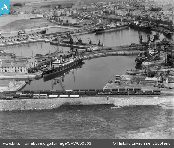
spw050803 SCOTLAND (1936). Ardrossan Harbour. An oblique aerial photograph taken facing north-east.
© Copyright OpenStreetMap contributors and licensed by the OpenStreetMap Foundation. 2024. Cartography is licensed as CC BY-SA.
Nearby Images (25)
SPW050801

SPW050803

SPW050804

SPW056870

SAR018740

SPW056896

SPW050815

SPW056866

SPW019561

SPW050789

SPW050806

SPW050795

SPW050798

SPW056871

SPW049054

SPW049055

SPW049056

SPW049057

SPW050793

SPW056869

SPW050788

SPW050796

SPW050799

SPW050809

SPW050805

Details
| Title | [SPW050803] Ardrossan Harbour. An oblique aerial photograph taken facing north-east. |
| Reference | SPW050803 |
| Date | 1936 |
| Link | Canmore Collection item 1257822 |
| Place name | |
| Parish | ARDROSSAN |
| District | CUNNINGHAME |
| Country | SCOTLAND |
| Easting / Northing | 222479, 642038 |
| Longitude / Latitude | -4.8208418048589, 55.639423140164 |
| National Grid Reference | NS225420 |
Pins
 |
 Billy Turner |
Thursday 17th of December 2015 06:26:34 PM |
 mannidaze |
Thursday 11th of September 2014 11:17:49 PM | |
MB |
Saturday 8th of September 2012 10:55:07 AM | |
MB |
Saturday 8th of September 2012 10:53:57 AM | |
MB |
Saturday 8th of September 2012 10:52:21 AM | |
MB |
Saturday 8th of September 2012 10:50:03 AM |


