
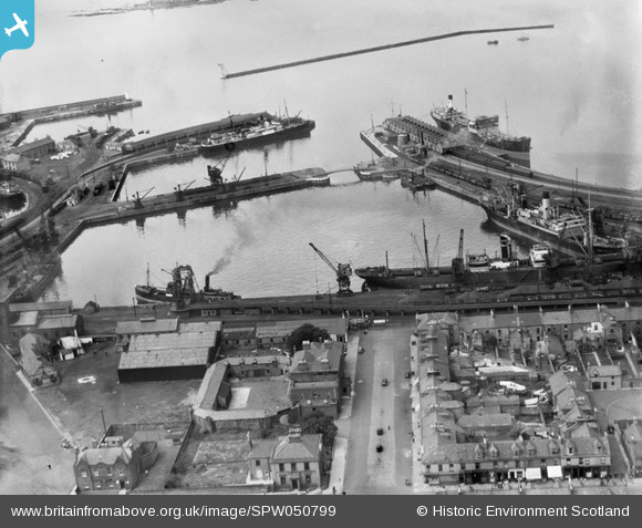
spw050799 SCOTLAND (1936). Ardrossan Harbour. An oblique aerial photograph taken facing west.
© Copyright OpenStreetMap contributors and licensed by the OpenStreetMap Foundation. 2024. Cartography is licensed as CC BY-SA.
Nearby Images (27)
SPW050788

SPW050796

SPW050799

SPW050809

SPW049056

SPW049057

SPW050793

SPW056869

SPW049054

SPW049055

SPW050794

SPW050810

SPW050811

SPW050816

SPW050795

SPW050798

SPW056871

SPW050815

SPW056866

SPW056896

SPW050808

SPW050801

SPW050803

SPW050804

SPW056870

SPW050812

SAR018740

Details
| Title | [SPW050799] Ardrossan Harbour. An oblique aerial photograph taken facing west. |
| Reference | SPW050799 |
| Date | 1936 |
| Link | Canmore Collection item 1257818 |
| Place name | |
| Parish | ARDROSSAN |
| District | CUNNINGHAME |
| Country | SCOTLAND |
| Easting / Northing | 222688, 642188 |
| Longitude / Latitude | -4.8176219691961, 55.640845706082 |
| National Grid Reference | NS227422 |
Pins
Be the first to add a comment to this image!


