
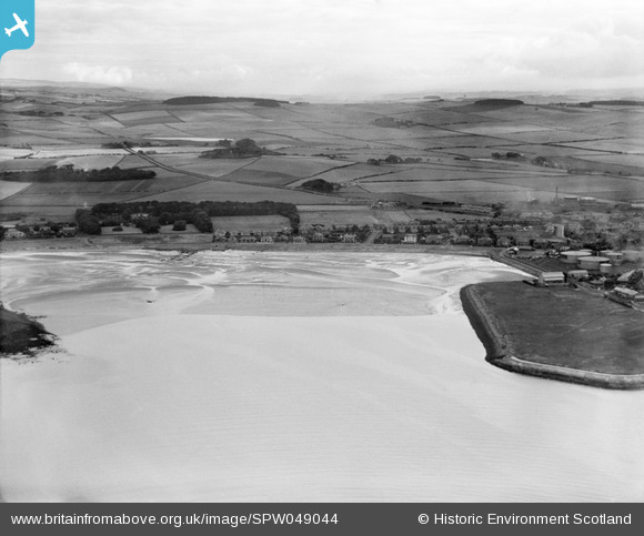
spw049044 SCOTLAND (1935). Ardrossan, general view, showing North Crescent Road and Dalry Road. An oblique aerial photograph taken facing north-east.
© Copyright OpenStreetMap contributors and licensed by the OpenStreetMap Foundation. 2024. Cartography is licensed as CC BY-SA.
Details
| Title | [SPW049044] Ardrossan, general view, showing North Crescent Road and Dalry Road. An oblique aerial photograph taken facing north-east. |
| Reference | SPW049044 |
| Date | 1935 |
| Link | Canmore Collection item 1257952 |
| Place name | |
| Parish | ARDROSSAN |
| District | CUNNINGHAME |
| Country | SCOTLAND |
| Easting / Northing | 222890, 643210 |
| Longitude / Latitude | -4.8150747587762, 55.65009220308 |
| National Grid Reference | NS229432 |


