
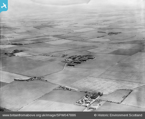
spw047886 SCOTLAND (1935). Gullane Aerodrome, Drem. An oblique aerial photograph taken facing east.
© Copyright OpenStreetMap contributors and licensed by the OpenStreetMap Foundation. 2024. Cartography is licensed as CC BY-SA.
Nearby Images (2)
SPW047886

SPW047889

Details
| Title | [SPW047886] Gullane Aerodrome, Drem. An oblique aerial photograph taken facing east. |
| Reference | SPW047886 |
| Date | 1935 |
| Link | Canmore Collection item 1259451 |
| Place name | |
| Parish | DIRLETON |
| District | EAST LOTHIAN |
| Country | SCOTLAND |
| Easting / Northing | 350929, 681331 |
| Longitude / Latitude | -2.7873415282715, 56.022424177971 |
| National Grid Reference | NT509813 |
Pins
Be the first to add a comment to this image!
User Comment Contributions
Became RAF Drem in 1939, and briefly HMS Nighthawk in 1945, before closure in 1946. The grass airstrip saw use by Spitfire and Hurricane squadrons in 1940, defending Edinburgh and the Firth of Forth against German raiders. Practically all the infrastructure has now gone - the hangars have been demolished |
 MB |
Tuesday 10th of December 2013 10:27:09 AM |
See also the Wikipedia entry: en.wikipedia.org/wiki/RAF_Drem |
MB |
Tuesday 10th of December 2013 10:27:09 AM |


