
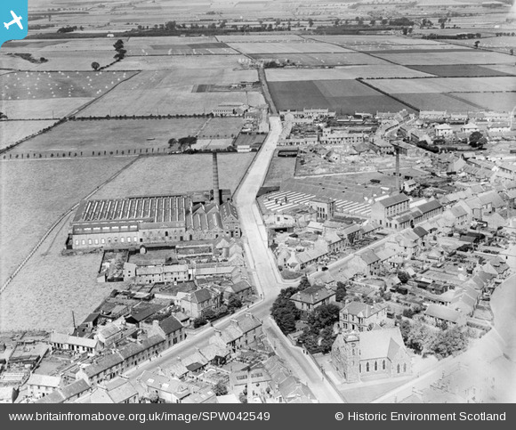
spw042549 SCOTLAND (1933). Kirkcaldy, general view, showing Hawkleymuir Linen Factory and Viewforth Parish Church, Viewforth Street. An oblique aerial photograph taken facing north.
© Copyright OpenStreetMap contributors and licensed by the OpenStreetMap Foundation. 2025. Cartography is licensed as CC BY-SA.
Nearby Images (2)
SPW042549

SPW042550

Details
| Title | [SPW042549] Kirkcaldy, general view, showing Hawkleymuir Linen Factory and Viewforth Parish Church, Viewforth Street. An oblique aerial photograph taken facing north. |
| Reference | SPW042549 |
| Date | 1933 |
| Link | Canmore Collection item 1257642 |
| Place name | |
| Parish | KIRKCALDY AND DYSART |
| District | KIRKCALDY |
| Country | SCOTLAND |
| Easting / Northing | 329450, 693700 |
| Longitude / Latitude | -3.1351689086976, 56.130865308303 |
| National Grid Reference | NT295937 |
Pins
User Comment Contributions
The road running diagonally from bottom left is now St Clair Street. The one from centre to top centre is Park Road. Lawson Street now runs in front of the former linen factory. The white diagonal lines opposite the factory are linen whitening in the sun on the bleachfields - a common feature of Kirkcaldy at the time. |
 BillFerguson |
Tuesday 26th of June 2012 12:54:06 PM |