
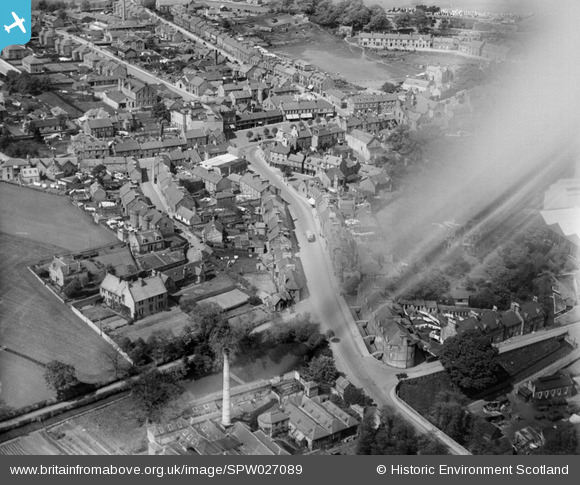
spw027089 SCOTLAND (1929). Penicuik, general view, showing Bridge Street and High Street. An oblique aerial photograph taken facing north.
© Copyright OpenStreetMap contributors and licensed by the OpenStreetMap Foundation. 2024. Cartography is licensed as CC BY-SA.
Nearby Images (15)
SPW027089

SPW042190

SPW042191

SPW027087

SPW027088

SPW027095

SPW027096

SPW027097

SPW042192

SPW051113

SPW051114

SPW051115

SPW051116

SPW051117

SPW051119

Details
| Title | [SPW027089] Penicuik, general view, showing Bridge Street and High Street. An oblique aerial photograph taken facing north. |
| Reference | SPW027089 |
| Date | 1929 |
| Link | Canmore Collection item 1256608 |
| Place name | |
| Parish | PENICUIK (MIDLOTHIAN) |
| District | MIDLOTHIAN |
| Country | SCOTLAND |
| Easting / Northing | 323565, 659741 |
| Longitude / Latitude | -3.2201931771432, 55.824880866016 |
| National Grid Reference | NT236597 |
Pins
Be the first to add a comment to this image!


