
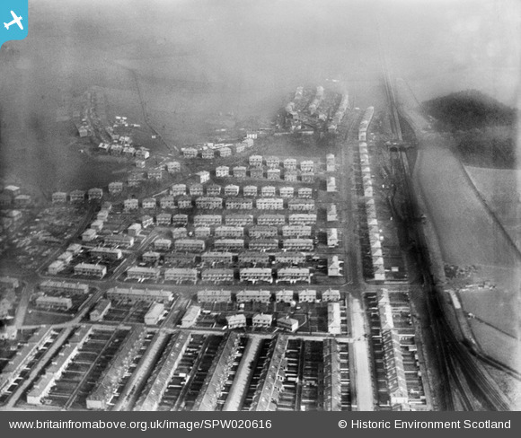
spw020616 SCOTLAND (1928). Kings Park Housing Estate, Glasgow. An oblique aerial photograph taken facing east.
© Copyright OpenStreetMap contributors and licensed by the OpenStreetMap Foundation. 2024. Cartography is licensed as CC BY-SA.
Nearby Images (6)
SPW020613

SPW020616

SPW020234

SPW020235

SPW020615

SPW022167

Details
| Title | [SPW020616] Kings Park Housing Estate, Glasgow. An oblique aerial photograph taken facing east. |
| Reference | SPW020616 |
| Date | 1928 |
| Link | Canmore Collection item 1259263 |
| Place name | |
| Parish | CATHCART (CITY OF GLASGOW) |
| District | CITY OF GLASGOW |
| Country | SCOTLAND |
| Easting / Northing | 259350, 660750 |
| Longitude / Latitude | -4.245148476649, 55.819509075329 |
| National Grid Reference | NS594608 |
Pins
 paulmck1888 |
Saturday 11th of July 2020 12:20:17 PM |


