
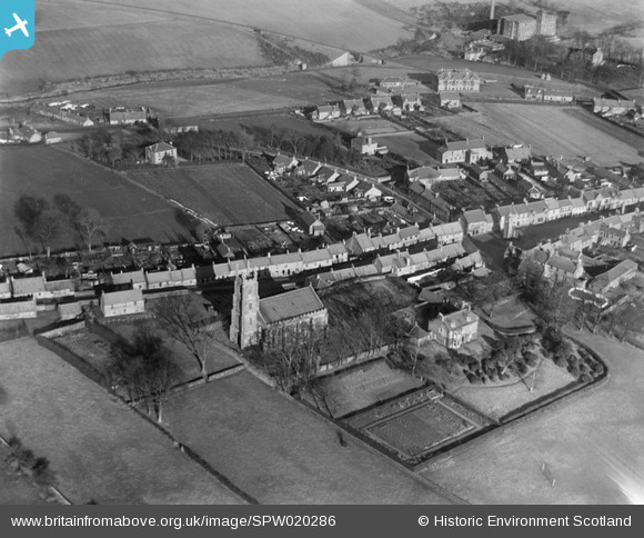
spw020286 SCOTLAND (1928). Clackmannan, general view, showing High Street and Parish Church. An oblique aerial photograph taken facing north.
© Copyright OpenStreetMap contributors and licensed by the OpenStreetMap Foundation. 2024. Cartography is licensed as CC BY-SA.
Nearby Images (3)
SPW020286

SPW020268

SPW020267

Details
| Title | [SPW020286] Clackmannan, general view, showing High Street and Parish Church. An oblique aerial photograph taken facing north. |
| Reference | SPW020286 |
| Date | 1928 |
| Link | Canmore Collection item 1256200 |
| Place name | |
| Parish | CLACKMANNAN |
| District | CLACKMANNAN |
| Country | SCOTLAND |
| Easting / Northing | 291021, 691874 |
| Longitude / Latitude | -3.7524876744924, 56.107239427276 |
| National Grid Reference | NS910919 |
Pins
Be the first to add a comment to this image!


