
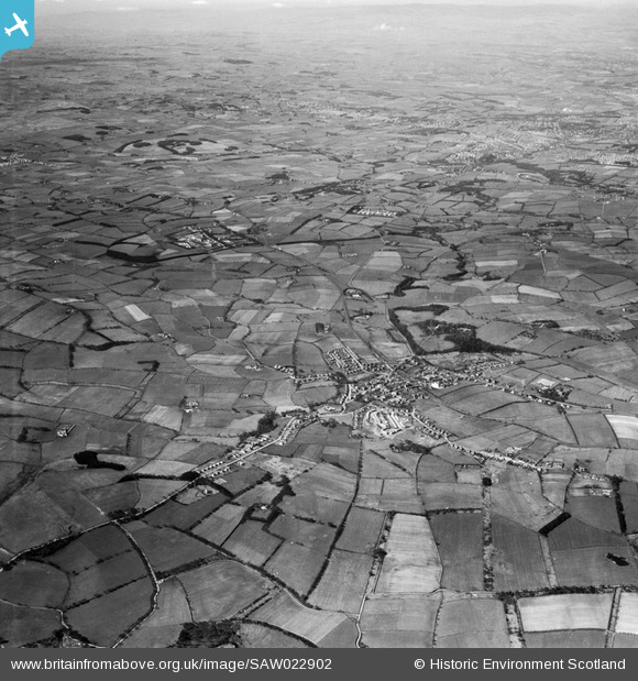
saw022902 SCOTLAND (1949). East Kilbride, general view. An oblique aerial photograph taken facing west.
© Copyright OpenStreetMap contributors and licensed by the OpenStreetMap Foundation. 2024. Cartography is licensed as CC BY-SA.
Details
| Title | [SAW022902] East Kilbride, general view. An oblique aerial photograph taken facing west. |
| Reference | SAW022902 |
| Date | 1949 |
| Link | Canmore Collection item 1269252 |
| Place name | |
| Parish | EAST KILBRIDE (SOUTH LANARKSHIRE) |
| District | EAST KILBRIDE |
| Country | SCOTLAND |
| Easting / Northing | 262398, 654453 |
| Longitude / Latitude | -4.1933536542937, 55.763843500883 |
| National Grid Reference | NS624545 |
Pins
 Mark |
Tuesday 19th of January 2016 05:31:32 PM | |
Mark |
Tuesday 19th of January 2016 05:30:52 PM | |
GusF |
Thursday 29th of August 2013 04:38:14 PM | |
JenthePen |
Saturday 15th of September 2012 10:03:02 PM | |
JenthePen |
Saturday 15th of September 2012 09:43:33 PM | |
GusF |
Wednesday 11th of July 2012 12:12:45 PM | |
stuall |
Monday 2nd of July 2012 04:49:42 PM | |
stuall |
Monday 2nd of July 2012 04:45:11 PM | |
stuall |
Monday 2nd of July 2012 04:40:59 PM | |
Effenbee |
Thursday 28th of June 2012 10:57:01 PM | |
graham |
Wednesday 27th of June 2012 10:51:54 PM | |
Gordonm2 |
Tuesday 26th of June 2012 05:42:52 PM |


