
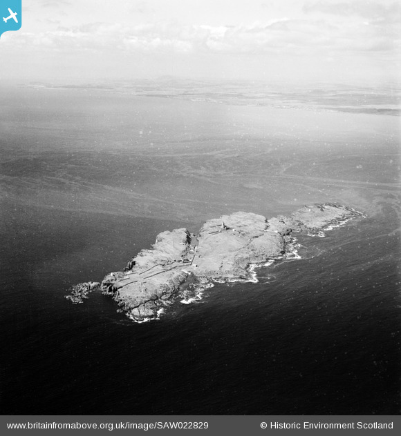
saw022829 SCOTLAND (1949). Isle of May, Firth of Forth. An oblique aerial photograph taken facing west.
© Copyright OpenStreetMap contributors and licensed by the OpenStreetMap Foundation. 2024. Cartography is licensed as CC BY-SA.
Details
| Title | [SAW022829] Isle of May, Firth of Forth. An oblique aerial photograph taken facing west. |
| Reference | SAW022829 |
| Date | 1949 |
| Link | Canmore Collection item 1269233 |
| Place name | |
| Parish | MARITIME - FIFE |
| District | MARITIME |
| Country | SCOTLAND |
| Easting / Northing | 365100, 699500 |
| Longitude / Latitude | -2.562358358833, 56.186917119744 |
| National Grid Reference | NT651995 |
Pins
 Norman |
Tuesday 12th of January 2016 01:34:54 PM | |
Andy A |
Monday 12th of May 2014 01:54:27 AM | |
Andy A |
Monday 12th of May 2014 01:53:19 AM | |
Andy A |
Monday 12th of May 2014 01:52:57 AM | |
Andy A |
Monday 12th of May 2014 01:52:38 AM | |
Andy A |
Monday 12th of May 2014 01:52:26 AM | |
Andy A |
Monday 12th of May 2014 01:52:05 AM |
User Comment Contributions
 The Isle of May, in the Firth of Forth, site of the "Battle" of May Island, on the night of 31 January 1918. |
Brian Wilkinson |
Friday 25th of May 2012 02:57:03 PM |


