
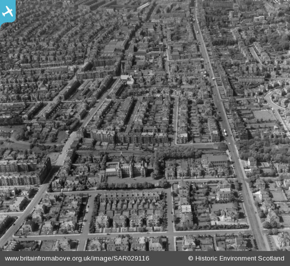
sar029116 SCOTLAND (1957). Mayfield Gardens and Mayfield Road Edinburgh, Midlothian, Scotland. An oblique aerial photograph taken facing North.
© Copyright OpenStreetMap contributors and licensed by the OpenStreetMap Foundation. 2024. Cartography is licensed as CC BY-SA.
Nearby Images (2)
SAR029116

SPW027140

Details
| Title | [SAR029116] Mayfield Gardens and Mayfield Road Edinburgh, Midlothian, Scotland. An oblique aerial photograph taken facing North. |
| Reference | SAR029116 |
| Date | 1957 |
| Link | Canmore Collection item 1438518 |
| Place name | |
| Parish | EDINBURGH (EDINBURGH, CITY OF) |
| District | CITY OF EDINBURGH |
| Country | SCOTLAND |
| Easting / Northing | 326827, 671647 |
| Longitude / Latitude | -3.1713481760939, 55.932350377527 |
| National Grid Reference | NT268716 |
Pins
 Andy A |
Monday 30th of January 2017 10:13:15 PM | |
Andy A |
Monday 30th of January 2017 10:12:57 PM | |
Starcross |
Monday 30th of January 2017 06:45:49 AM | |
Starcross |
Monday 30th of January 2017 06:41:46 AM | |
Starcross |
Monday 30th of January 2017 06:32:39 AM |


