
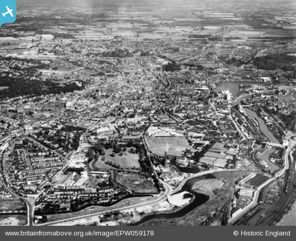
epw059178 ENGLAND (1938). The town centre and environs, Ipswich, from the west, 1938. This image has been produced from a copy-negative.
© Copyright OpenStreetMap contributors and licensed by the OpenStreetMap Foundation. 2024. Cartography is licensed as CC BY-SA.
Nearby Images (8)
EPW059178

EPW001823

EPW001831

EPW041398

EPW005252

EPW032875

EPW005249

EPW005255

Details
| Title | [EPW059178] The town centre and environs, Ipswich, from the west, 1938. This image has been produced from a copy-negative. |
| Reference | EPW059178 |
| Date | 8-September-1938 |
| Link | |
| Place name | IPSWICH |
| Parish | |
| District | |
| Country | ENGLAND |
| Easting / Northing | 616011, 244372 |
| Longitude / Latitude | 1.1510912370149, 52.055136279521 |
| National Grid Reference | TM160444 |
Pins
 britannia |
Saturday 2nd of July 2022 09:19:25 PM |
User Comment Contributions
Ipswich |
 Class31 |
Tuesday 28th of October 2014 08:44:09 PM |


