
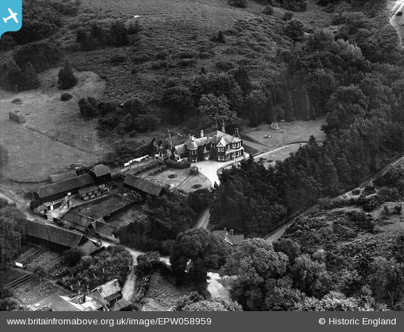
epw058959 ENGLAND (1938). Tyting Farm, Guildford, 1938
© Copyright OpenStreetMap contributors and licensed by the OpenStreetMap Foundation. 2024. Cartography is licensed as CC BY-SA.
Details
| Title | [EPW058959] Tyting Farm, Guildford, 1938 |
| Reference | EPW058959 |
| Date | 30-August-1938 |
| Link | |
| Place name | GUILDFORD |
| Parish | |
| District | |
| Country | ENGLAND |
| Easting / Northing | 502255, 148591 |
| Longitude / Latitude | -0.53541862848936, 51.226823562961 |
| National Grid Reference | TQ023486 |
Pins
 percommode |
Wednesday 1st of January 2014 10:37:12 PM |


