
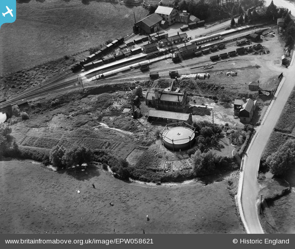
epw058621 ENGLAND (1938). Gas Works at Broad Bridge and Bromyard railway station, Bromyard, 1938
© Copyright OpenStreetMap contributors and licensed by the OpenStreetMap Foundation. 2024. Cartography is licensed as CC BY-SA.
Nearby Images (6)
EPW058621

EPW058620

EPW058622

EPW058624

EPW058625

EPW058623

Details
| Title | [EPW058621] Gas Works at Broad Bridge and Bromyard railway station, Bromyard, 1938 |
| Reference | EPW058621 |
| Date | 13-August-1938 |
| Link | |
| Place name | BROMYARD |
| Parish | BROMYARD AND WINSLOW |
| District | |
| Country | ENGLAND |
| Easting / Northing | 365799, 254833 |
| Longitude / Latitude | -2.5003634342382, 52.190273679876 |
| National Grid Reference | SO658548 |
Pins
 John W |
Sunday 16th of April 2017 04:39:05 PM |
User Comment Contributions
Bromyard station was originally opened in 1877, when it was a terminus of a branch line from near Worcester. It became a through station in 1897, when the GWR completed a link from Bromsgrove westwards to Steens Bridge at the end of a short branch from Leominster. Most of the track was single line with passing loops at Bromyard and several other stations. The line west of Bromyard was closed in 1952 but used for storing condemned wagons for several years afterwards. The line east of Bromyard closed in 1964. |
John W |
Thursday 14th of July 2016 10:08:11 PM |


