
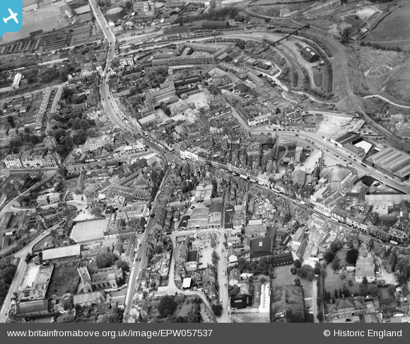
epw057537 ENGLAND (1938). The town centre, Stourbridge, 1938
© Copyright OpenStreetMap contributors and licensed by the OpenStreetMap Foundation. 2024. Cartography is licensed as CC BY-SA.
Nearby Images (2)
EPW057537

EPW035920

Details
| Title | [EPW057537] The town centre, Stourbridge, 1938 |
| Reference | EPW057537 |
| Date | 9-June-1938 |
| Link | |
| Place name | STOURBRIDGE |
| Parish | |
| District | |
| Country | ENGLAND |
| Easting / Northing | 390122, 284382 |
| Longitude / Latitude | -2.1453869261912, 52.456927508528 |
| National Grid Reference | SO901844 |
Pins
 Rovaly |
Friday 1st of July 2016 06:40:50 AM | |
John W |
Sunday 19th of June 2016 03:22:44 PM | |
John G. |
Tuesday 17th of February 2015 04:39:00 PM | |
 |
John G. |
Tuesday 17th of February 2015 04:18:04 PM |
John G. |
Tuesday 17th of February 2015 04:11:54 PM | |
 |
John G. |
Tuesday 17th of February 2015 04:07:26 PM |
 |
John G. |
Tuesday 17th of February 2015 04:01:21 PM |
John G. |
Tuesday 17th of February 2015 03:52:32 PM | |
Martin |
Thursday 26th of December 2013 11:00:33 AM | |
Martin |
Thursday 26th of December 2013 10:58:29 AM | |
Martin |
Thursday 26th of December 2013 10:57:37 AM |


