
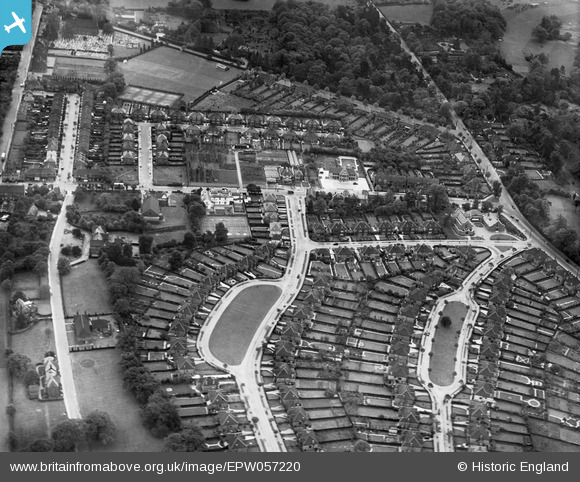
epw057220 ENGLAND (1938). Shirley Avenue, Barnfield Avenue and environs, Shirley, 1938
© Copyright OpenStreetMap contributors and licensed by the OpenStreetMap Foundation. 2024. Cartography is licensed as CC BY-SA.
Nearby Images (9)
EPW057220

EPW057222

EPW057224

EPW057221

EPW057223

EPW057226

EPW057225

EPW057218

EPW057219

Details
| Title | [EPW057220] Shirley Avenue, Barnfield Avenue and environs, Shirley, 1938 |
| Reference | EPW057220 |
| Date | 26-May-1938 |
| Link | |
| Place name | SHIRLEY |
| Parish | |
| District | |
| Country | ENGLAND |
| Easting / Northing | 535566, 165742 |
| Longitude / Latitude | -0.052053157992886, 51.374029999124 |
| National Grid Reference | TQ356657 |
Pins
 Paul Wendon |
Tuesday 16th of February 2021 09:35:36 PM | |
Paul Wendon |
Tuesday 16th of February 2021 09:21:09 PM | |
Paul Wendon |
Tuesday 16th of February 2021 09:18:18 PM | |
Paul Wendon |
Tuesday 16th of February 2021 09:17:51 PM | |
Paul Wendon |
Tuesday 16th of February 2021 09:16:31 PM | |
Paul Wendon |
Tuesday 16th of February 2021 09:16:06 PM | |
Paul Wendon |
Tuesday 16th of February 2021 09:15:21 PM | |
Paul Wendon |
Tuesday 16th of February 2021 09:14:58 PM | |
Paul Wendon |
Tuesday 16th of February 2021 09:14:27 PM | |
Paul Wendon |
Tuesday 16th of February 2021 09:13:54 PM | |
Paul Wendon |
Tuesday 16th of February 2021 09:12:00 PM |


